Advancing our understanding of flooding in New Zealand
Researchers from NIWA are developing the first, nationally consistent flood inundation hazard and risk assessment for New Zealand. It’s vital research that’s revealing how changing rainfall patterns, rising sea levels, and the way land is used could – and likely will – affect flood risk across the country.
On this page
“Currently, we don’t have a clear understanding of the national flood hazard and risk across Aotearoa. Critical decisions about mitigating and adapting to climate change are being made in this knowledge vacuum.”
That’s the official problem description on the NIWA website, but in conversation Dr Emily Lane, project lead and principal scientist, puts it a little more bluntly.
“There’s this glaring hole in our information about flooding; New Zealand has no national scale understanding of what our flood hazard is,” she says.
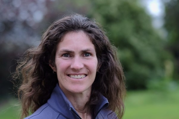
Dr Emily Lane – Principle Scientist: Natural Hazards and Hydrodynamics at NIWA
With government funding secured through the MBIE-administered Endeavour Fund, the ambitious 5-year project seeks to increase flood resilience across Aotearoa New Zealand by looking first at the ‘where’ – the flood mapping, then at the ‘what’ – the associated risks and consequences. But the project goes much deeper than that.
“The flood inundation hazard and risk assessment is really just the surface of this research. The team is also looking at who are the communities most impacted and how does that affect them? And then we bring it all together and ask, ‘now what?’
The Endeavour project seeks to develop an enduring resource for people undertaking future risk assessments. However, the question of ‘how far can you look ahead’ is something Dr Lane and scientists the world over are grappling with at the moment.
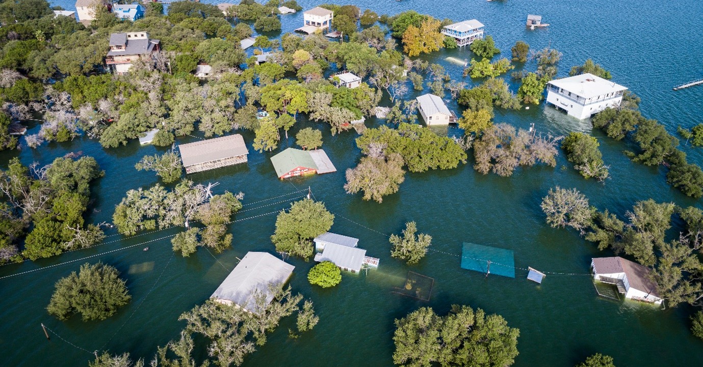
"The Auckland Anniversary flood is the poster child of that where it exceeded not only the 1-in-100-year prediction but the 1-in-100-year-under-climate-change.
“So is this a complete regime shift? How do we know that that's the biggest flood you're ever going to get. And how might that change under climate change?
“A lot of the records we have might only be for 50 years, so if you're trying to look at, well, what's a 1-in-100-year event, let alone a 1-in-200 or a 1-in-500 event, it becomes very tricky. It's one thing to have the information, but that doesn't guarantee that you make the right decisions.”
Uncertainty is unavoidable when it comes to flood risk and hazard research, so it's unsurprising that it's one of the project's core themes. But what makes this research unique is its incorporation of mātauranga Māori within each of the strands of the project.
"Many Māori communities have a deep connection to their land and a holistic understanding of how that land should be treated." Dr Lane says this is something she and her research team have embraced.
“In many cases, a solution that might be acceptable for a pākehā community might not be acceptable for Māori, and there is often a very good reason for that.”
Dr Lane describes the example of Ngāti Kahungunu around Napier Hastings with the confluence of the Tūtaekurī and Ngaruroro rivers. Local iwi know that stop banks are needed to protect their communities and urupā, but they are investigating whether they can be wider to allow the river to move and be closer to its natural state.
“There are actually a lot of benefits to that, not just in terms of flooding. If the river can move around, then you're getting more groundwater recharge which is important for times of drought.
“If you get it right for Māori, you know, it's going to work for everyone,” Dr Lane emphasises as a key takeaway from this project.
When reflecting on the role government funding has played for this research, Dr Lane says it "was just too big a thing to bite off by itself."
“Being able to deal with our flooding in a robust way is such an important thing for Aotearoa. The Endeavour fund has been absolutely critical in providing the support needed to pull this project together and advance our understanding of flooding in New Zealand.”
A national flood inundation hazard and risk assessment for Aotearoa New Zealand(external link) — NIWA
“This project is using Waiwera as a case study to understand how small communities are impacted by flooding.”
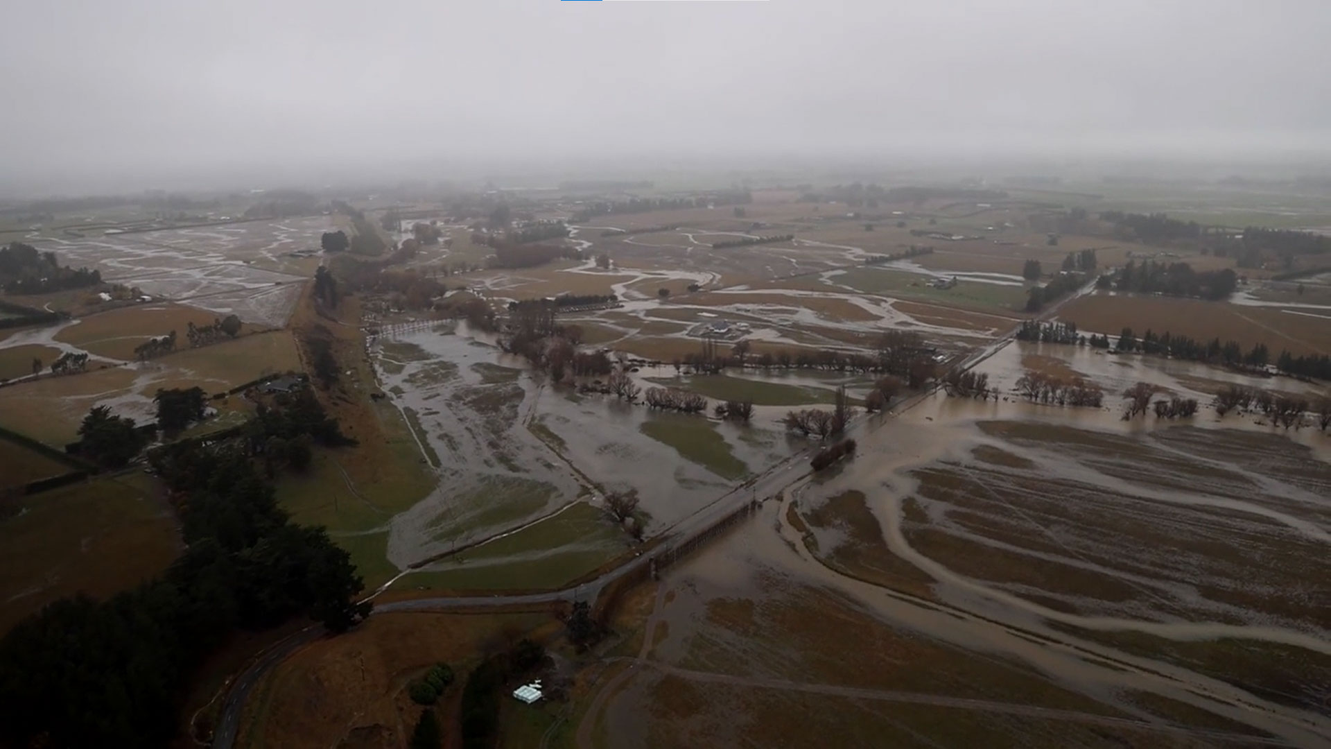
“Waiwera has experienced severe flooding events.”